Hi, I am Philipp Arndt!
I integrate large amounts of multi-mission satellite remote sensing products and other geospatial data to produce actionable insights into how our planet is changing, for managing the natural resources that we need and protecting the places that we love.
Since January 2025, I have been a Data Scientist on the Research and Innovation Team at Global Fishing Watch, focusing on satellite imagery and data fusion. I build machine-learning models that detect, classify, and identify vessels in optical (Sentinel-2, PlanetScope) and radar (Sentinel-1, NISAR) satellite imagery, and fuse these detections with vessel-tracking data (AIS, VMS) to help advance transparency of human activity at sea. This includes finding “dark” vessels that do not broadcast their positions, and mapping activities such as transshipments, bottom trawling, sand dredging, and small-scale fishing in coastal waters.
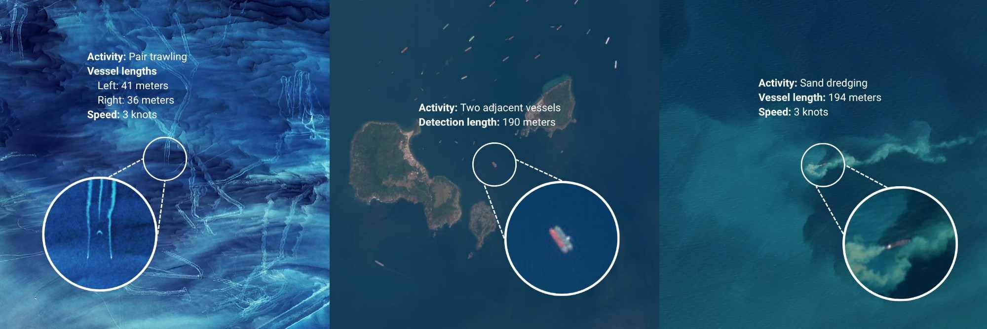
Examples of vessel activity seen in Sentinel-2 imagery (image: Global Fishing Watch). Read more in Global Fishing Watch's story on the July 2025 release of global Sentinel-2 vessel detections: An AI Breakthrough in Ocean Monitoring: Satellite Imagery Provides an Unprecedented View of Global Vessel Activity (10 July 2025).
In 2024 I finished my PhD in Earth Science with the Scripps Polar Center at Scripps Institution of Oceanography in San Diego (advised by Helen Fricker), where I was supported as a Future Investigator in NASA Earth and Space Science. My PhD research focused on automatically detecting surface meltwater lakes on the Greenland and Antarctic ice sheets and measuring their depths, which is crucial information for assessing ice sheet stability and building models that can confidently predict future sea-level rise. I developed FLUID-SuRRF, a fully automated framework for lake detection and depth retrieval in NASA ICESat-2 laser-altimetry photon data, and scaled it with distributed high-throughput computing to process 138 TB of data from five melt seasons on both ice sheets.
Prior to my PhD, I studied Engineering Physics with a focus on Data Science and Machine Learning at Chalmers University of Technology and Mathematics/Economics at Yale University.
In my spare time I enjoy connecting with people who share my love for the outdoors, often while hiking, backcountry skiing or rock climbing.